MythologyMythologyDocumentariesFestivalspersonswarsBeutiful HellasArtFun
Εμφάνιση αναρτήσεων με ετικέτα TurkeySites. Εμφάνιση όλων των αναρτήσεων

4.8.17

Parion, Turkey

Thasos was founded by the Parians, as also Parium, a city on the Propontis (Strab. 10.5.7).
- Strabo, Geography
Parion (or Parium Greek: Πάριον) was a Greek city of Adrasteia in Mysia on the Hellespont. Its bishopric was a suffragan of Cyzicus, the metropolitan see of the Roman province of Hellespontus.
Map of the ruins of the ancient city Parium, Asia Minor. Alternative Title: Plan des ruines de Parium. Date: 1822

After Ceos are Naxos1 and Andros,2 considerable islands, and Paros, the birth-place of the poet Archilochus. Thasos3 was founded by Parians, and Parium,4 a city in the Propontis. In this last place there is said to be an altar worthy of notice, each of whose sides is a stadium in length. In Paros is obtained the Parian marble, the best adapted for statuary work.5

1 Naxia.

2 Andro.

3 Taschos.

4 Kemars.

5 The marble was taken from Mt. Marpessus. Pliny xxxvi. 5; Virg Æn. 6, Marpesia cautes.

The Geography of Strabo. Literally translated, with notes, in three volumes. London. George Bell & Sons. 1903.
The city was founded probably about 3,000 years ago as a colony by settlers from Eretria (Greek polis from the island of Euboea) and the island of Paros in the Aegean Sea. Parion was a member of the Delian League. In the city, there were defensive towers, and at least four temples.

Re-founded in 709 B.C., the ancient city of Parion is located in the village of Kemer in the township of Biga in Çanakkale province of Turkey, currently. A major coastal city with two harbors in the Roman period, Parion had intensive relations with Thrace and Anatolia throughout history. This was the main customs station through which all Istanbul-bound goods from Greece and the Aegean had to pass.
On the history: Located near Lampsacus, it was a colony probably founded by Eretria and Paros.It belonged to the Delian League. In the Hellenistic period it came under the domain of Lysimachus, and subsequently the Attalid dynasty. In Roman times, it was a colonia, within the province of Asia; after that province was divided in the 4th century, it was in the province of Hellespontus.
Statue of Orpheus from Parion (the 1st century BCE) - Çanakkale Archaeological Museum

The ancient coinage of Parium is quite abundant, attesting to its great output and advanced mint (in Hellenistic times, the city's badge shown on coins was the Gorgoneion).
The Acts of the martyr St. Onesiphorus prove that there was a Christian community there before 180. Other saints worthy of mention are: St. Menignus, martyred under Decius and venerated on 22 November; St. Theogenes, bishop and martyr, whose feast is observed on 3 January; St. Basil, bishop and martyr in the ninth century, venerated on 12 April.

A port of great strategic importance on the Hellespont between Lampsakos and Priapos. The city may have been founded by Parion, son of Jason, chief of the settlers of Erythrai; or by the mythic Parilarians, together with colonists from Erythrai and Miletos.
Parion enjoyed enviable prosperity because of its port; and once the kingdom of Pergamon was established, it came under the control of the Attalid dynasty. It passed to the Romans in 133 B.C. under the testament of Attalos III, and under Augustus must have been a flourishing center as the numerous coins coming from Parion designate the city Colonia Pariana Iulia Augusta. Strabo (Geogr. 13.588) records a colossal altar constructed at Parion by Hermokreon; and we know that prior to 354 B.C. the sculptor Praxiteles executed a statue of Eros there.

Le Quien (Oriens christianus I, 787-90) mentions 14 bishops, the last of whom lived in the middle of the fourteenth century. An anonymous Latin bishop is mentioned in 1209 by Innocent III (Le Quien, op. cit., III, 945) and a titular bishop in 1410 by Eubel (Hierarchia Catholica medii ævi, I, 410).
Bronze amphora from Parion - Çanakkale Archaeological Museum

At first a suffragan of the Archbishopric, Parium became an autocephalous archdiocese as early as 640 (Heinrich Gelzer, Ungedruckte ... Texte, 535) and remained so till the end of the 13th century. Then the Emperor Andronicus II Palaeologus made it a metropolis under the title of Pegon kai Pariou.

In 1354 the residential see of Pegae and Parium (the Latin forms of both names) were suppressed, the incumbent metropolitan receiving in exchange the See of Sozopolis in Thrace (Miklosich and Müller, "Acta patriarchatus Constantinopolitani", I, 109, 111, 132, 300, 330). This was the end of the residential see.

The see is included in the Catholic Church's list of titular sees.

The ruins of Parium were under Ottoman rule at the Greek village of Kamares (the vaults), on the small cape Tersana-Bournou in the caza and sandjak of Bigha.
The statue of Artemis found at the ancient city of Parion 
The excavation is being conducted by Professor Cevat Başaran, an instructor in the archaeology department at Erzurum’s Atatürk University, and is being carried out in six zones of the ancient city. 

The marble sculpture was dug out in pieces at Odeion, one of the six excavation sites. Başaran, the head of the excavation, has announced that the sculpture depicts a clothed woman, is 1.70 cm tall and approximately 1,800 years old, and is a high quality sculpture of its kind. The excavators also found marble sculptures depicting animals including sheep and dogs. 

“The bow and arrow in her hand indicates that the sculpture belongs to Artemis [Diana], the goddess of hunting, the wilderness and wild animals,” Başaran said. 

Archaeological research: 
Archaeological work has been conducted at the ruins of Parion for many years. The existence of ancient Parion was no secret to the father of the Turkish archeology - Osman Hamdi Bey. He found there a sarcophagus, later transported to the Archaeological Museum in Istanbul. Since 2005, a team of archaeologists in Parion has been directed by Professor Cevat Başaran from Atatürk University in Erzurum.
The most important discoveries made by his team are tombs and sarcophagi from the area of ​​Parion necropolis. Among them, it is worth mentioning a 2200-year-old sarcophagus, which was unearthed in 2009. Golden earrings found in it bear the symbol of Eros, and they were accompanied by numerous rings and some fragments of the crown decorated with precious stones. These finds allow the presumption that a rich person was buried there, and she was called the princess of Parion by the discoverers of the tomb. Unfortunately, the bones of the people buried in the necropolis have not been well preserved because of soil moisture due to the proximity of the sea. A royal crown and gold coins with the figure of the sun god were discovered in another tomb.

In addition to these special sarcophagi, around 200 graves have been discovered in the necropolis, often with for the dead, including bottles for tears, oil lamps, and toys. Sometimes the funeral gifts enable the identification of the occupation of the person buried there, as in the case of the tomb, with bronze fragments of a fishing rod from the 1st century AD. Unfortunately, many of the tumuli surrounding Parion, have been plundered by treasure hunters.

Archaeological excavations in Parion are also carried out in a theater, an odeon, and baths, as well as in six areas on a hillside overlooking the ancient city. Important discovery was made in 2011 when a marble block was found, with an inscription in the Phrygian language. Because of this discovery, Parion is now considered as the north-western boundary of ancient Phrygian civilization.

2,700 year-old healing water discovered in Parion ancient city in Turkey's Çanakkale
A 2,700-year-old water well, one of the nine ancient wells located in Turkey's Çanakkale province, still provides the essential drink that is considered as the "source of life," with special "healing properties" and is attributed to be the source of beauty in the region.
Located in the ancient Greek city of Parion in Çanakkale's Biga district, the well still contains water, archeological studies in the area have revealed.

According to Professor Vedat Keleş from Ondokuz Mayıs University's Archaeology Department, excavations have unearthed nine wells in the ancient site, which experienced chronic water shortages.

"These ancient peoples tried to overcome the water shortage through aqueducts and water wells located in various areas" Keleş told the Anadolu Agency, noting that the village's name in Turkish, "Kemer" is derived from aqueducts.

He noted that only one of the wells still has drinking water, which is believed to have healing properties.

"Ancient sources mention that this water had healing properties and was beneficial for the skin and stomach disorders" Keleş said, adding that beauty of the women of this region especially had a reputation, which he said could be attributed to this water.

"Anthropological studies will give us clearer answers regarding this matter in the near future," Keleş said.

Parion, also called Parium, was an ancient Greek city founded in 709 B.C. It had two major harbors during the Roman era, and served as the main "customs station" for Istanbul-bound goods from the Aegean.

Archaeologists have been carrying out excavations at the ancient site since 2005. Sarcophagi, and graves, as well as ancient artifacts were found in the area.

Sightseeing: 
Based on the excavation findings, Professor Basaran says that Parion was a great city, ruled by the wealthy elite of the Hellenistic era. The professor hopes that the ruins of Parion will become a tourist attraction comparable to Ephesus. Honestly, we need to warn the travellers interested in exploring Parion that these plans relate to the very distant future, as the current excavations are in no way prepared to receive tourists.

At the entrance to the village of Kemer, there is a faded signboard about Parion (in Turkish). On a hill, in the vicinity of this board, you can see the remains of fortifications. In the center of the village, a signpost leads to the necropolis, where the excavation work is carried out. The official information panel at the necropolis states that the entrance is dangerous and prohibited. However, you can ask for the permission to take some photos. Do not overuse the patience of the archaeologists and do not enter the area of the necropolis.

The most important ancient buildings of Parion are located to the north of the center of Kemer, about 600 meters from the necropolis area. There are the remains of a theater, an odeon, and Roman baths.

The finds from excavations conducted in Parion, dating back to the archaic, Hellenistic and Roman periods, are presented in display cases in the Archaeology Museum in Çanakkale. One of the most interesting exhibits is a 2400-year-old amphora made of bronze, found in 2005. The vessel is 34 cm high, and it is decorated with the theme depicting the ecstatic procession of dancing figures: the god Dionysus, a satyr, and maenads.

Visitor tips: 
The village of Kemer is not a place to stop overnight as there are no accommodation options there. We recommend finding a room in a hotel in Lapseki, located to the west. Alternatively, you can book a room in Biga or Karabiga, further to the east. In Kemer, there are no restaurants or shops, so it is worth to stock up on supplies of food and beverages before the trip.

Getting there: 
By car: take E90 route from Çanakkale to the north-east, through Lapseki. Turn left (to the north) after 74 km, and follow Kemer (Parion) signposts. The local, but good quality road takes you to Kemer village, 12 km from the crossroads.

Source/Photography/Bibliography
Strabo, Geography
http://www.asiaminorcoins.com
B. V. Head, Historia Numorum (1911)
M. Grant, From imperium to Auctoritas (1946)id., Emerita 20 (1952)
D. Magie, Roman Rule in Asia Minor (1950)
http://www.perseus.tufts.edu
L. Robert, Hellenica 9 (1950), 10 (1955), 11-12 (1960); id., Villes d'Asie Mineure (2d ed. 1962); L. Laurenzi, Riv. Ist. Naz. Arch. St. Arte 5-6 (1956-57); id., Ann. Sc. Arch. Ital. Atene 33-34 (1957); D. Nikolov, Archeologia (Sofia) 5 (1963).
http://turkisharchaeonews.net
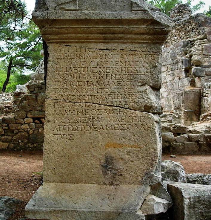
P. Frisch (ed.), Die Inschriften von Parion (Bonn, 1983) (Inschriften griechischer Städte aus Kleinasien 25).
https://www.dailysabah.com
Herbermann, Charles, ed. (1913). "Parium". Catholic Encyclopedia. New York: Robert Appleton Company. This article incorporates text from a publication now in the public domain: Herbermann, Charles, ed. (1913). "Parium". Catholic Encyclopedia. New York: Robert Appleton.
https://wikipedia.org

4.5.17

Side, Turkey

Side (pronounced see-deh,Greek: Σίδη) is an ancient Greek city  on the southern Mediterranean coast of Turkey. It is approximately 15kms east of Antalya (one of Turkey`s largest cities) and is located on a small peninsula only 800m in length. In this pretty town, modern architecture, chic shops and late night bars stand in juxtaposition with the ruins of an ancient city. 

Flanked by two stretches of golden beach, surrounded by the sparkling waters of Mediterranean on both sides and bestowed with the endless archeological wonders - Side has aptly prospered as one of the most popular resorts for holidaymakers from across the globe.

The town’s West Beach is closer to hotels, has calm water and fine sand, offers watersports, and is (not surprisingly) popular. If you’re craving a more relaxed day, though, head in the opposite direction. The East Beach is a bit rockier, but it’s less crowded.

History
Strabo and Arrian both record that Side was founded by Greek settlers from Cyme in Aeolis, a region of western Anatolia. This most likely occurred in the 7th century BC. Its tutelary deity was Athena, whose head adorned its coinage.

Dating from the tenth century B.C., its coinage bore the head of Athena (Minerva), the patroness of the city, with a legend. Its people, a piratical horde, quickly forgot their own language to adopt that of the aborigines.
Ancient Greek coin of Athena, from Side

Possessing a good harbour for small-craft boats, Side's natural geography made it one of the most important places in Pamphylia and one of the most important trade centres in the region. According to Arrian, when settlers from Cyme came to Side, they could not understand the dialect. After a short while, the influence of this indigenous tongue was so great that the newcomers forgot their native Greek and started using the language of Side. Excavations have revealed several inscriptions written in this language. The inscriptions, dating from the 3rd and 2nd centuries BC, remain undeciphered, but testify that the local language was still in use several centuries after colonisation. Another object found in the excavations at Side, a basalt column base from the 7th century BC and attributable to the Neo-Hittites, provides further evidence of the site's early history. The name Side may be Anatolian in origin, meaning pomegranate.

Next to no information exists concerning Side under Lydian and Persian sovereignty.

Alexander the Great occupied Side without a struggle in 333 BC. Alexander left only a single garrison behind to occupy the city. This occupation, in turn, introduced the people of Side to Hellenistic culture, which flourished from the 4th to the 1st century BC. After Alexander's death, Side fell under the control of one of Alexander's generals, Ptolemy I Soter, who declared himself king of Egypt in 305 BC. The Ptolemaic dynasty controlled Side until it was captured by the Seleucid Empire in the 2nd century BC. Yet, despite these occupations, Side managed to preserve some autonomy, grew prosperous, and became an important cultural centre.

In 190 BC a fleet from the Greek island city-state of Rhodes, supported by Rome and Pergamum, defeated the Seleucid King Antiochus the Great's fleet, which was under the command of the fugitive Carthaginian general Hannibal. The defeat of Hannibal and Antiochus the Great meant that Side freed itself from the overlord-ship of the Seleucid Empire. The Treaty of Apamea (188 BC) forced Antiochus to abandon all European territories and to cede all of Asia Minor north of the Taurus Mountains to Pergamum. However, the dominion of Pergamum only reached de facto as far as Perga, leaving Eastern Pamphylia in a state of uncertain freedom. This led Attalus II Philadelphus to construct a new harbour in the city of Attalia (the present Antalya), although Side already possessed an important harbour of its own. Between 188 and 36 BC Side minted its own money, tetradrachms showing Nike and a laurel wreath (the sign of victory).
Ancient Greek coin of Side. Circa 205-100 BC. AR Tetradrachm (28mm, 16.46 g, 12h). Pa–, magistrate. Helmeted head of Athena right / Nike advancing left, holding wreath; to left, pomegranate above monogram.

In the 1st century BC, Side reached a peak when the Cilician pirates established their chief naval base and a centre for their slave-trade.

The consul Servilius Vatia defeated these brigands in 78 BC and later the Roman general Pompey in 67 BC, bringing Side under the control of Rome and beginning its second period of ascendancy, when it established and maintained a good working relationship with the Roman Empire.

Emperor Augustus reformed the state administration and placed Pamphylia and Side in the Roman province of Galatia in 25 BC, after the short reign of Amyntas of Galatia between 36 and 25 BC. Side began another prosperous period as a commercial centre in Asia Minor through its trade in olive oil. Its population grew to 60,000 inhabitants. This period would last well into the 3rd century AD. Side also established itself as a slave-trading centre in the Mediterranean. Its large commercial fleet engaged in acts of piracy, while wealthy merchants paid for such tributes as public works, monuments, and competitions as well as the games and gladiator fights. Most of the extant ruins at Side date from this period of prosperity.

Side was the home of Eustathius of Antioch, of the philosopher Troilus, of the fifth-century ecclesiastical writer Philip; of the famous lawyer Tribonian.

Side began a steady decline from the 4th century on. Even defensive walls could not stop successive invasions of highlanders from the Taurus Mountains. During the 5th and 6th centuries, Side experienced a revival, and became the seat of the Bishopric of Eastern Pamphylia. Arab fleets, nevertheless, raided and burned Side during the 7th century, contributing to its decline. The combination of earthquakes, Christian zealots and Arab raids, left the site abandoned by the 10th century, its citizens having emigrated to nearby Antalya.

In the 12th century, Side temporarily established itself once more as a large city. An inscription found on the site of the former ancient city shows a considerable Jewish population in early Byzantine times. However, Side was abandoned again after being sacked. Its population moved to Antalya, and Side became known as Eski Adalia 'Old Antalya' and was buried.
Ancient Greek coin of Side. Circa 360-333 BC. AR Stater (21mm, 10.65 g, 12h). Athena Parthenos standing left, holding Nike, shield, and spear; pomegranate to left, Pamphylian letters to right / Apollo standing left, holding branch and sacrificing out of phiale over altar to left; c/m to left: wolf(?) at bay right, crescent and cube above, bird below, all within incuse rectangle.

As capital of the Roman province of Pamphylia Prima, Side was ecclesiastically the metropolitan see. The earliest known bishop was Epidaurus, presiding at the Synod of Ancyra, 314. Others are John, fourth century; Eustathius, 381; Amphilochius, 426-458, who played an important part in the history of the time; Conon, 536; Peter, 553; John, 680-692; Mark, 879; Theodore, 1027-1028; Anthimus, present at the synod held at Constantinople in 1054; John, then counsellor to the Emperor Michael VII Ducas, presided at a council on the worship of images, 1082; Theodosius and his successor Nicetas, twelfth century. John, present at a synod at Constantinople in 1156. The Notitiae Episcopatuum continued to mention Side as a metropolis of Pamphylia until the thirteenth century. It does not appear in the "Notitia" of Andronicus III. From other documents we learn that in 1315 and for some time previous to that, Sidon had bishops of its own — the Bishop of Sinope was called to the position, but was unable to leave his own diocese; this call was repeated in 1338 and 1345. In 1397 the diocese was united with that of Attalia; in 1400 the Metropolitan of Perge and Attalia was at the same time the administrator of Side.

No longer a residential see, Side is today included in the Catholic Church's list of titular sees.

In 1895 Turkish Muslim refugees from Crete moved to the ruined town and called it Selimiye. Today, Side has become a popular holiday destination and experiences a new revival.

It was a popular spot for watching the solar eclipse of March 29, 2006.

Description
The great ruins are among the most notable in Asia Minor. They cover a large promontory where a wall and a moat separate it from the mainland. During medieval times, the wall and moat were repaired and the promontory houses a wealth of structures.

There are colossal ruins of a theatre complex, the largest of Pamphylia, built much like a Roman amphitheatre that relies on arches to support the sheer verticals. The Roman style was adopted because Side lacked a convenient hillside that could be hollowed out in the usual Greek fashion more typical of Asia Minor. The theatre is less preserved than the theatre at Aspendos, but it is almost as large, seating 15,000–20,000 people. With time and the shifting of the earth, the scena wall has collapsed over the stage and the proscenium is in a cataract of loose blocks. It was converted into an open-air sanctuary with two chapels during Byzantine times (5th or 6th century).

The well-preserved city walls provide an entrance to the site through the Hellenistic main gate (Megale Pyle) of the ancient city, although this gate from the 2nd century BC is badly damaged. Next comes the colonnaded street, whose marble columns are no longer extant; all that remains are a few broken stubs near the old Roman baths. The street leads to the a public bath, restored as a museum displaying statues and sarcophagi from the Roman period. Next is the square agora with the remains of the round Tyche and Fortuna temple (2nd century BC), a periptery with twelve columns, in the middle. In later times it was used as a trading centre where pirates sold slaves. The remains of the theatre, which was used for gladiator fights and later as a church, and the monumental gate date back to the 2nd century. The early Roman Temple of Dionysus is near the theatre. The fountain gracing the entrance is restored. At the left side are the remains of a Byzantine Basilica. A public bath has also been restored.

The remaining ruins of Side include three temples, an aqueduct, and a nymphaeum. Side's nymphaeum – a grotto with a natural water supply dedicated to the nymphs – was an artificial grotto or fountain building of elaborate design.

There is also a virtually unknown, but expansive site, up in the Taurus foothills, several miles inland, known locally as Seleucia. Virtually unknown to the outside world and not represented on the internet at all, it is the Roman garrison, built by Marc Anthony, to support the city of Side. It covers at least a couple of square miles and is almost completely unexcavated, apart from two weeks in 1975, when the Turkish government funded two weeks of excavations. The site was, apparently, finally abandoned in the 7th century, when an earthquake caused the spring which fed the site with water to dry up completely. Many of the buildings are in remarkably good shape, particularly since, due to the lack of available stone, a significant quantity of the sites stonework contains egg and gravel based concrete blocks.

Turkish archaeologists have been excavating Side since 1947 and intermittently continue to do so.

Monuments

Apollo Temple
Apollo Temple is situated next to the ancient harbor. The Temple has 6 Corinth Style columns on its front and back sitting on a 16x30m. stylobate, and 11 columns in the same style on each side. Each column is 8.90 m. high. The architrave ( horizontal stone blocks which are placed on the columns, which connect these columns to one another and which bear the rows of frieze, eave etc and the roof placed on itself. ) located on the columns is decorated with plant designs and Medusa heads.
This Temple is bearing Peripteros Style and also it is a monument belonging to 2nd century AD.

The temple of Athena

The remains of the temple of Athena - Greek goddess of wisdom, art and strategic war - are much more modest than the temple of Apollo are. In ancient times Athena was often chosen as a patron of cities, as was also the case in Side.

Again, this building was a peripteros of the Corinthian order, and its stylobate had the dimensions of 18 meters (59 feet) by 35 meters (115 feet), which means that in its heyday the temple of Athene exceeded the one dedicated to Apollo. Along its longer sides there once stood 13 columns, and along the shorter sides - 6 columns.

The appearance of the building during its prosperity can be reconstructed on the basis of the coins minted in Side. They showed Athena holding in her hands a model of the temple. Both the temple of Athena and the temple of Apollo were erected in the second half of the 2nd century AD.


Side City Walls
The section separating the peninsula from the main land was erected in 2nd century BC during the Hellenistic period, among the walls of the ancient city of Side which have survived through the present day. 
The walls on the side of the peninsula facing the sea were somehow demolished and than they were modified, constructed or repaired all over again during the Roman and Byzantine periods. Today, among those the walls on the southern edge have been buried under the sands. 
On the neck section of peninsula the walls which imply that the city became smaller for a while, date back to 4th century AD. 

The way in which the Hellenistic walls were constructed is very interesting. The inner side of these walls decorated cornice among the patterns of their outer surfaces and have three floors and each floor was built slightly towards the front as compared to the floor on which it seats, and as a result 2 paths were obtained on the walls for the soldiers. On the upper floor a simple balustrade wall is found while there are crenel holes on the walls in the central floor. In this way from both floors the possibility to fire attackers were provided.
The rooms used as depot etc at some points and the lower floors of the walls include only a bearing wall at some other points. At several points in these defense system strengthened with towers ( the total number of the towers are 13, some having a semi-circular and some others having a rectangular plan ), it is interesting that the paths of walkers which extended al along the walls ceased at the points corresponding to the rear section of the towers. It is possible that in these sections there were wooden bridges to provide for the passage.

Main gate and other gates
From the point of view of the military art the main gate of Side city is interesting. The gate is a system formed by semi-circular courtyard and two guarding towers, having 2 sections opening outside and inside of the city. Also in the other cities of the Pamphylia region ( like Perge, Sillyon ) the same gate model was used.
A monumental entrance with 2 arches was added to the gate in the form of two layers, presumably during the period of Pax Romana ( Roman Peace ). Both layers are made of the column groups formed by overlapping two Korinth style columns.
The reason for this addition was the decreasing the gate’s military importance. Inside the semi-circular courtyard is decorated with the statues placed inside these niches and also with niches separated by two layers of columns.
On city walls of Side other gates were also found, which were buried under the sands, bur the formation plan of these are different from the main gate. Among these different gates the friezes decorating the south eastern gate are very interesting. With big difficulty the south eastern gate was taken out of the sands. The spoils taken from the enemies like helmet, sword and shield are described on these friezes and these are exhibited in Side Museum.
Also this gate has a protocol entrance with two arches. These provide entry to the protocol courtyard, during the Byzantine reign the ground of which was covered with mosaics.

City fountain (Nymphaeum)
This big monumental fountain of Side is situated opposite the main gate and outside the citadel. With its current status, because the marble coating it has lost its original magnificence, embossed designs and statues on it are absent and the top floor of this three floored building has been ruined.
It is original length was 35 m and height was 15 m. 
The city is supposed to be constructed during the reign of Antonius Oius in around 150 BC , in the same period as the aqueducts of the city. The water to this Nymphaeum was brought from the aqueduct through a large water pipe. 
There was three floored high front side, the wings which extended towards the front on the sides and a wide pool with three sections surrounded by these. 
The front side of the fountain was decorated with three large overlapped niches, each having three water gutters. 
The arched niches were separated from one another by Corinth style columns. Inside the niches there were statues. Between the layers carried by the columns and also on the top sections there were decorated entablatures. 
Today, many statues and reliefs belonging to Side nymphaeum are kept in Side Museum.

Aqueduct

Columned streets and quarters
In Side there are 2 columned streets which start from the main gate, one advancing southwards and the other heading towards the south west, that is the city center. The 250 m long and 20 m wide street extending southwards is today covered with asphalt.
The columned streets have perfect underground drainage systems.

The building with sacred fountain
It is understood that this monument with fountain or monumental fountain located on the columned street extending from the main gate towards the city center belong tı the 5th or 6th century AD.

Houses with Peristyl
These houses are understood to be used also in the later Roman periods but built in the 2nd century BC. 
It is thought that in front of the house on the street the three rooms were shops and that they belonged probably to the owner of the house. 
Both the rooms and atrium host colored marble coverings. Clay water pipes in the coverings reveal the fact that there were water and bathroom in both houses.

Commercial agora and The Temple of Tykhe
The temple of Tyche in Side 

Commercial agora have the sizes of 90X95m and was built 2nd century AD. Only the foundations of this building which is made of a courtyard with the sizes 60X65m, the shops behind these and the stoats around this courtyard have survived through the present day. The building has a propylon (monumental gate in ancient architecture, located at the entrance of a building or a group of buildings. There are columns on its sides facing both the interior and the exterior ) facing the street. Shops doors overlooking the streets open to street and those of the shops overlooking the courtyard open to the courtyard.
There are nine shops some of which have doors opening to the stage building of the theater on the side leaning against the theater building. During its active times agora was the place hosting all kinds off cultural and commercial activities of the city. The trade of the slaves were also known to be conducted here during the periods when Side was also involved in privacy. It was revealed that circular plan building having 12 Korinth style columns which is situated in Agora courtyard and whose picture is seen on the Side coins, was erected in the name of the god of good fortune Tykhe.
The building’s roof had the shape of a pyramid with 12 sides. On its dome shaped cailing there were the symbols of the Zodiac signs ( symbols of the star groups ).
Latrina structure ( toilet ) suitable for 24 people is also located at the north western corner of agora. Latrine is in the form of a semi-circular hall with marble covered walls. Owing to its interesting plan and formation, the toilet, which has survived through our day without substantial damage, is among the places worth visiting around Side.

Theater
Theater is the most magnificent building of Side and dates back to 2nd century AD. Its back was built in a way to face the Mediterranean Sea.
Side was founded is plain and it was necessary to perform a large construction work.
On a hill of low altitude only the lower half of the cavea could be placed. The cavea with a seating capacity of 16.000 persons had a diameter of 120 m. This structure has 2 floors.
The lower floor includes a semi circular gallery and it is covered with an extended archway placed on wide columns connected with wide arches. Some of the openings between these wide columns open to either a shop or an inner gallery or other covered places used for other purposes. 
The walking path dividing the cavea into two, there were passages leading from these inner galleries directly to 3,5 m wide diazoma. The spectators entered through these gates to a diazoma and at the lower section of the theater reserved for them descended to take their seats.
From the diazoma it was not possible to reach the upper seating section of cavea. At the upper part the spectators had to first ascend the internal stairways connecting the lower galleries to the other galleries. Respectively Cavea’s upper and lower section have 29 and 22 rows of seats. Since it also hosted the shows performed with wild animals and gladiators in Roman period in addition to theater shows, meetings and festivities, the orchestra of the structure was surrounded with a 1,85 m. high wall in order to protect the spectators. 
In the period of Christianity the theater was also used as open theater. For this purpose to the head of cavea two small chapels were added.
The stage building of theater had three floors ( 21m ) with its side turned towards the spectators being made of granite and marble and being decorated with overlapped column pairs and the niches between these, also the statues placed inside these niches. The upper row of columns is in Korinth style, while the lower roe of columns exhibits Ion sytle. On the smooth surfaces between the floors there are friezes. 
By five gates it is possible to ascend from the stage building to the orchestra. On the doors of some of the rooms on the lower floor the presence of iron railings leads to the opinion that these were the cages of animals or gladiators. There are passages leading from commercial agora to the lower floor. On the upper floor rooms were dedicated to the use of the artists. 
The theater building was made an important element of this defense system and the gates opening from the stage section to the agora was closed by laying bricks in the period when the area occupied by the city was decreased and the intermediate city walls were built for this purpose.

Agora Baths (Side Museum)
This building has been restored and it is being used as Side Museum today determined to be erected in 5th century AD. The entrance was provided from the section with two gates in the original form of the structure althogh this baths museum is entered from a section of torn down walls. Necessary hot water was provided by a furnace in the baths. The building was heated by passing the hat air below within the walls and below the ground.
Sections of bath:
• Frigidarium ( cold section ) : There is cold water pool descended by stairways, in the adjacent section with a circular plan. It is possible to view here also the section in which the water was provided from the aqueduct to the building of baths.
• Sudatorium ( Hottest section – place of perspiring – sauna ) 
• Calderium ( Hot bathing section ) : There are hot water pools in caldarium. 
• Tepidarium ( Tepid section )
• Apodyterium ( Dressing room )
• Palaestra ( The courtyard which hosted the open air activities like sports etc.)

All these sections are used as the exhibition sections of Side museum and this museum contains three halls, one of which is a garden and being uncovered. The paleastra of the baths structure is used as the garden in which Side Museum exhibits some stone monuments today. 
In Side Museum the majority of the monuments exhibited are stone made monuments of the local origin. The most interesting among these are as follows:

In uncovered hall
The oldest monument the base of the basalt column which belongs to the period of Late Hittite kingdoms exhibited in the museum. It was brought here in time for the commercial reasons and does not belong to the region. 8-9. century BC.
On the south eastern gate the friezes bearing the descriptions of war spoils taken from the enemies. Among these descriptions are the swords, armors etc...

Hall 1
Women statues dressed in a fashion called Side Type located inside the four niches in this section.

Hall 2 and 3
The statue of the merchants’ protective god Hermes described with a money bag in his hand and a Hermes head, Nike statues, Hygeia statue, Herakles statues.. 
Sarcophaguses with Eros ( God of love ) a composition comprised of the statues of the three mythological Kharits called as three beauties, relifs depicting The birth of Aphrodite and Punishing of Ixion, discobal, sphinxes, Ares, Asclepios, Athena, Apollon statues and head of Apollon, various men and women heads.
Furthermore coins, a bronze arm belonging to the city of Side, inscriptions and amphoras are the most interesting pieces of collection of Side museum exhibited in the covered section. 
The majority of the monuments of sculpture in Side museum are the copies made in the Roman period ( 2nd century AD ) looking at the original monuments of Hellen sculptors. And also the sculptors of Side created successfull original monuments to form their trend in art. Among these original monuments there are heads of men and women which reflect the psychological states and characters of the persons.

Monumental Gate
One of the columned streets starting at the main gate of the city advances towards the city center and reaches the monumental gate and this gate is 13m high today, after passing in front of the baths. On the lento of this monumental gate there was probably a quadriga statue. 
During the period when the city area was made smaller due to the defense requirements this monumental gate was made narrower by laying bricks inside of it (4th century) and served as the main entrance gate of the city.

Vespasianus monumental fountain
In front of it there is a pool. It is a fascinating monument with a round niche in its front side and two projecting parts on its both sides, each having two full and two half Korinth style columns. The arch of the central niche has an opening of 7m and is 15m high. Both inside the central niche there were statues and the columned sections on the sides.

The fountain with three pools
It is opposite the Vespasianus fountain and around the monumental gate. There is a columned street between the baths and fountain. 
It is 3rd century monument.
Only some statues and marble pools the remains of the korinth style column heading which once were decorating its surface have survived through the present day.

Dionysus Temple
It is situated between the road and the theatre and at the point where the harbour street starts after the entry through the monumental gate to the city.
It is comprised of a cella built with the sizes of 7*17m on a podium and the semi columns placed as attached to this temple. 

There are four columns in its entrance section with headings in Corinth style made of red granite. It is a monument belonging to the 3rd century BC.

Harbor Street
Harbor street is the columned street connecting the monumental gate to the harbor and there are temples around it. There must be shady roofs ( stoat ) placed on the columns according to the classical style and the shops must be present behind these stoats. 
It is understood that there were advancing westwards and two more columned roads intersecting the harbor street. These two are currently under the village buildings.

Theater’s Basilica
It is located at the part of this street close to the theater and to the west of the harbor street. Partially it is undamaged. This Byzantine building dates back to the 5th century AD. Having three sections and an abscissa the monument has a plan resembling a square.

Harbor Baths
This building was erected in 2nd century AD situated right next to the harbor filled with sands and was undergone many repair works. The harbor baths were built to allow the sailors coming back on the land to clean and to rest in the ancient cities.
These baths heated from the ground and the walls. At the entrance is Apodyterium ( dressing room ). A passage hall provides entry from here to four rooms with wide domes and these domes placed side by side. It is possible to advance from each one of these rooms to another one. It is also possible to enter from the dressing room to a hall through a door and another door provides entry from this hall in to hot section ( Caldarium ), the widest hall of the building hosting marble pools. This hall opens other two successive large halls. These are first tepid section ( Tepiderium ) and cold section ( Frigidarium ).

Source/Photography/Bibliography

"The Ancient Library". Retrieved 2006-11-19.
"Side - History of the City". Retrieved 2006-11-19.
Catholic Encyclopedia, 1907-1912, s.v. 'Sidon'
Annuario Pontificio 2013 (Libreria Editrice Vaticana, 2013, ISBN 978-88-209-9070-1), p. 971
"Aspendos - Perge - Side". Retrieved 2006-11-19.
Πισιδίας, Ιερά Μητρόπολις. «Ιερά Μητρόπολις Πισιδίας - ΣΙΔΗ (Side)». 
In 1895 Turkish people from Crete moved to the ruined town and called it Selimiye.
Side Travel Guide
Turkish Riviera - Side

30.1.17

Termessos, Turkey


Situated more than 1000m above sea level, the ancient site of Termessos, 30km northwest of Antalya, is one of Turkey’s prime attractions. Its dramatic setting and well-preserved ruins, tumbling from the summit of the mountain and enclosed within a national park – Güllük Dağ Milli Parkı – merit at least an afternoon of exploration.


Despite its close proximity to Lycia, Termessos was actually a Pisidian city, inhabited by the same warlike tribe who settled in the Anatolian Lakeland, around Isparta and Eğirdir, during the first millennium BC. The city’s position, commanding the road from the Mediterranean to the Aegean, enabled Termessians to extract customs dues from traders; a wall across the valley is believed to be the site of their customs post. Later, in 70 BC, 

Termessos signed a treaty with Rome, under which their independence was preserved – a fact the Termessians proudly expressed by never including the face or name of a Roman emperor on their coinage. The city must have been abandoned quite early, probably after earthquake damage in 243 AD, and has only been surveyed, never excavated.

Σολύμους δ´ εἶναί φασι τοὺς Καβαλεῖς· τῆς γοῦν Τερμησσέων ἄκρας ὁ ὑπερκείμενος λόφος καλεῖται Σόλυμος, καὶ αὐτοὶ δὲ οἱ Τερμησσεῖς Σόλυμοι καλοῦνται. Πλησίον δ´ ἐστὶ καὶ ὁ Βελλεροφόντου χάραξ καὶ ὁ Πεισάνδρου τάφος τοῦ υἱοῦ {αὐτοῦ} πεσόντος ἐν τῇ πρὸς Σολύμους μάχῃ. Ταῦτα δὲ καὶ τοῖς ὑπὸ τοῦ ποιητοῦ λεγομένοις ὁμολογεῖται· περὶ μὲν γὰρ τοῦ Βελλεροφόντου φησὶν οὕτωςΔεύτερον αὖ Σολύμοισι μαχέσσατο κυδαλίμοισι.περὶ δὲ τοῦ παιδὸς αὐτοῦΠείσανδρον δέ οἱ υἱὸν Ἄρης ἆτος πολέμοιομαρνάμενον Σολύμοισι κατέκτανεν.Ἡ δὲ Τερμησσός ἐστι Πισιδικὴ πόλις ἡ μάλιστα καὶ ἔγγιστα ὑπερκειμένη τῆς Κιβύρας. 

- Στράβων

History
The mythical founder of the city is Bellerophon.

What is known of Termessos' history commences principally at the time that Alexander the Great surrounded the city in 333 BC; he likened the city to an eagle's nest and in one of few cases, failed to conquer it. Arrian, one of the ancient historians who dealt with this event and recorded the strategic importance of Termessos, notes that even a small force could easily defend it due to the insurmountable natural barriers surrounding the city. 

The location of the city at the mountain pass from the Phrygian hinterland to the plains of Pamphylia is described by Arrian, Annals 1,26,6. Alexander wanted to go to Phrygia from Pamphylia, and according to Arrian, the road passed by Termessos. There are other passes much lower and easier to access, so why Alexander chose to ascend the steep Yenice pass is still a matter of dispute. It is even said that his hosts in Perge sent Alexander up the wrong path. Alexander wasted a lot of time and effort trying to force his way through the pass, which had been closed by the Termessians, and so, in anger he turned toward Termessos and surrounded it. Probably because he knew he could not capture the city, Alexander did not undertake an assault, but instead marched north and vented his fury on Sagalassos.

According to Strabo, the inhabitants of Termessos called themselves the Solymi and were a Pisidian people. Their name, as well as that given to the mountain on which they lived, was derived from Solymeus, an Anatolian god who in later times became identified with Zeus, giving rise there to the cult of Zeus Solymeus (Solim in Turkish). This name still exists as a surname in some people in Antalya region, providing evidence to their Solymi heritage. The coins of Termessos often depict this god and give his name.


The historian Diodorus has recorded in full detail another unforgettable incident in the history of Termessos. In 319 BC, after the death of Alexander, one of his generals, Antigonos Monophtalmos, proclaimed himself master of Asia Minor and set out to do battle with his rival Alcetas, whose base of support was Pisidia. His forces were made up of some 40,000 infantry, 7,000 cavalry, and included numerous elephants as well. Unable to vanquish these superior forces, Alcetas and his friends sought refuge in Termessos. The Termessians gave Alcetas their word that they would help him.


At this time, Antigonos came and set up camp in front of the city, seeking delivery of his rival. Not wanting their city to be dragged into disaster for the sake of a Macedonian foreigner, the elders of the city decided to hand Alcetas over to Antigonos. However, the youths of Termessos wanted to keep their word and refused to go along with the plan. The elders sent Antigonos an envoy to inform him of their intent to surrender Alcetas. According to a secret plan to continue the fight, the youth of Termessos managed to leave the city. Learning of his imminent capture and preferring death to being handed over to his enemy, Alcetas killed himself. The elders delivered his corpse to Antigonos. After subjecting the corpse to all manner of abuse for three days, Antigonos departed Pisidia leaving the corpse unburied. The youth, greatly resenting what had happened, recovered Alcetas' corpse, buried it with full honours, and erected a beautiful monument to his memory.

Termessos was obviously not a port city, but its lands stretched south-east all the way to the Gulf of Attaleia (Antalya). Because the city possessed this link to the sea it was taken by the Ptolemies.

An inscription found in the Lycian city of Araxa yields important information about Termessos. According to this inscription, in the 2nd century BC, Termessos was at war for unknown reasons with the league of Lycian cities, and again in 189 BC found itself battling its Pisidian neighbour Isinda. At this same time we find the colony of Termessos Minor being founded 85 km in the south-south-west (Oinoanda) in the 2nd century BC. Termessos entered into friendly relations with Attalos II, king of Pergamon, the better to combat its ancient enemy Selge. Attalos II commemorated this friendship by building a two-storied stoa in Termessos.
Termessos was an ally of Rome, and so in 71 BC was granted independent status by the Roman Senate; according to this law its freedom and rights were guaranteed. This independence was maintained continuously for a long time, the only exception being an alliance with Amyntas king of Galatia (reigned 36-25 BC). This independence is documented also by the coins of Termessos, which bear the title "Autonomous".

The end of Termessos came when its aqueduct was crushed in an earthquake, destroying the water supply to the city. The city was abandoned (year unknown), which helps to explain its remarkable state of preservation today.

Monuments
A thorough exploration of the ancient site can be quite strenuous; steep climbs are necessary to reach many of the key sights. Bring sturdy footwear and lots of water – there’s nowhere to buy supplies beyond the park entrance – and time summer visits to avoid the midday sun. After checking the site map at the car park you’ll need to climb a good fifteen minutes to reach the first remains of any interest. On the way, you pass a number of well-labelled, though mainly inaccessible, ruins, including the aqueduct and cistern high on the cliff face to the left of the path.


The King’s Road and city walls

The second-century AD King’s Road was the main road up to Termessos, close to which the massive lower and upper city walls testify to a substantial defence system. The central part of the city lies beyond the second wall, to the left of the path. Its surviving buildings, formed of square-cut grey stone, are in an excellent state of repair, their walls standing high and retaining their original mouldings. In part, this is due to the inaccessibility of the site; it’s hard to imagine even the most desperate forager coming up here to pillage stone.


The necropolis

Uphill from the Odeon, Termessos’ necropolis holds an incredible number of sarcophagi dating from the first to the third centuries AD. Most are simple structures on a base, though some more elaborate ones were carved from the living rock, with inscriptions and reliefs.


Tomb of Alcatus

Set in a dramatic mountaintop location, the so-called Tomb of Alcatus is widely accepted as the mausoleum of the general, a pretender to the governorship of Pisidia. The tomb itself is cave-like and undistinguished, but the carvings on its facade are remarkable, particularly one depicting a mounted soldier, with a suit of armour, a helmet, a shield and a sword – the armour of a foot soldier – depicted lower down to the right of the figure.

Gymnasium and theatre

While the first building you come to once you pass through Termessos’ mighty walls is the well-preserved gymnasium and bath complex, this is far overshadowed by the nearby theatre. One of the most magnificently situated in Turkey, it’s set on the edge of a steep gorge, with a backdrop of staggered mountains. Greek in style, it had seating space for 4200 spectators, and although some seats are missing, it’s otherwise in an excellent state of preservation.


Gymnasium

The agora, Corinthian temple and odeon

At the far end of the open grassy space of the agora, west of the theatre, a Corinthian temple is approached up a broad flight of steps, with a six-metre-square platform. The smaller theatre or Odeon on the far side of the agora was, according to inscriptions, used for horse and foot races, races in armour, and, more frequently, wrestling. The walls of the building rise to almost 10m, surrounded by four temples. Only one – that of Zeus Solymeus, god of war and guardian of the city of Termessos – is in a decent state of repair.
Odeon


Source/Photography/Bibliography
http://www.ehw.gr
Lanckoroński N.P., Städte Pamphyliens und Pisidiens, Wien 1892
Texier C., Asie Mineure, Description Géographique, Historique et Archéologique des Provinces et des Villes de la Chersonnése d’Asie, Paris 1862
Bieber Μ., The History of the Greek and Roman Theatre, Princeton 1961
Ciancio Rossetto P. – Pisani Sartorio G. (eds), Teatri Greci e Romani, alle Origini del Linguaggio
rappresentato, Roma 1994
http://www.turkeytravelplanner.com/
De Bernardi Ferrero D., Teatri classici in Asia Minore II. Città di Pisidia, Licia e Caria, Roma 1969,
Studi di Architettura Antica
https://en.wikipedia.org
De Bernardi Ferrero D., Teatri classici in Asia Minore IV. Deduzioni e proposte, Roma 1974, Studi di
Architettura Antica
Bean G.E., Turkey’s Southern Shore. An Archaeological Guide, London 1979
1. Η αρχαία πόλη ταυτίστηκε το 1841 από τον Schönborn. H αρχική ταύτιση επιβεβαιώθηκε το 1847 από τους Άγγλους Spratt και Forbes.

2. Για τη μυθοπλασία σχετικά με την πρώιμη ιστορία των Τερμησσέων, βλ. Kosmetatou, E., “Pisidia and the Hellenistic Kings”, AncSoc 28 (1997), σελ. 6. O Σόλυμος σχετίζεται και με την ίδρυση μιας άλλης πισιδικής πόλης, της Αριασσού. Σχετικά με το μύθο και τη λατρεία του Σολύμου, βλ. Kosmetatou, E., “The Hero Solymos on the Coinage of Termessos Major”, SNR 76 (1997), σελ. 50 κ.ε.

3. TAM III.1.103, 127, 135· Στράβ. 13. 630.

4. Ομ., Ιλ. 6. 155-210. Ο Βελλερεφόντης εξεστράτευσε εναντίον των Σολύμων, κοντά στη Λυκία.

5. Είναι ενδεικτικό ότι ο Στράβωνας κάνει σαφή διάκριση μεταξύ της γλώσσας των Σολύμων, της πισιδικής, της ελληνικής και της λυδικής. Βλ. σχετικά, Στράβ. 13. 631. Επιπλέον, παρά το γεγονός ότι η διάλεκτος αυτή εξαφανίστηκε με την πάροδο του χρόνου, φαίνεται πως παρέμειναν σε χρήση τα κύρια ονόματα.

6. Βλ. σχετικά, Αρριαν., Ανάβ. Ι 27.5, 28.1-2.

7. Δεν είναι γνωστό αν οι κάτοικοι της Τερμησσού γνώριζαν τα σχέδια του Μακεδόνα να κατακτήσει ολόκληρη την Πισιδία. Επίσης, παραμένει αδιευκρίνιστο αν βρίσκονταν σε θέση ισχύος προκειμένου να επιβάλουν τους όρους τους στον Αλέξανδρο. Γεγονός παραμένει ότι ο Μακεδόνας σε συνεργασία με τον Αντίγονο φρόντισε για το οδικό δίκτυο της γύρω περιοχής βγάζοντας την Τερμησσό από την προηγούμενη απομόνωσή της.

8. Ο Περδίκκας στο διάστημα 322-320 π.Χ. κατάφερε να αποκτήσει τον έλεγχο της Καππαδοκίας, της Παφλαγονίας, της Πισιδίας και της Ισαυρίας.

9. Βλ. σχετικά Kosmetatou, E., “Pisidia and the Hellenistic Kings”, AncSoc 28 (1997), σελ. 13, σημ. 27.

10. Είναι ιδιαίτερα ενδιαφέρον το ότι οι κάτοικοι της Πισιδίας φαίνεται πως υποστήριζαν τα επεκτατικά σχέδια του Περδίκκα.

11. Οι ολοένα αυξανόμενες φιλοδοξίες του Περδίκκα είχαν ως αποτέλεσμα τη δημιουργία πολλών μετώπων εναντίον  του. Με προτροπή του Αντιγόνου δημιουργήθηκε συμμαχία που περιλάμβανε τους Αντίπατρο και Κρατερό. Την ίδια περίοδο, ο Πτολεμαίος Α΄ Σωτήρ της Αιγύπτου στράφηκε εναντίον του Περδίκκα. Ο τελευταίος  ηττήθηκε τελικά στην Αίγυπτο και δολοφονήθηκε από ανθρώπους του περιβάλλοντός του. Σχετικά με το σχηματισμό των  δύο μετώπων εναντίον του Περδίκκα, βλ. Διόδ. Σ. 18.25.4.

12. Στην πραγματικότητα έπρεπε να ξανακερδίσει την υποστήριξη των εναπομεινάντων υποστηρικτών  του Περδίκκα, οι οποίοι φαίνεται πως είχαν ακόμη ισχυρά ερείσματα στην περιοχή.

13. Υπολογίζεται ότι το 319 π.Χ. ο στρατός του έφθανε τους 20.000 άνδρες. Βλ. σχετικά Kosmetatou, E., “Pisidia and the Hellenistic Kings”, AncSoc 28 (1997), σελ. 15, σημ. 35. Από τη δύναμη αυτή, τουλάχιστον 6.000 άνδρες ήταν Πισιδείς μισθοφόροι αφοσιωμένοι στον αρχηγό τους. Αυτοί αποτελούσαν υπολογίσιμη δύναμη, αν αναλογιστεί κανείς ότι επρόκειτο για ικανότατους πολεμιστές, οι οποίοι επιπλέον γνώριζαν καλά την ορεινή και δύσβατη περιοχή τους. Επιπλέον, πρέπει να λάβει κανείς υπόψη και το γεγονός ότι ο Αλκέτας ήταν ένας χαρισματικός ηγέτης με μεγάλη απήχηση κυρίως στους νέους της περιοχής.

14. Είναι ενδεικτικό το ότι οι νέοι παρέμειναν πιστοί στον Αλκέτα. Περισυνέλεξαν το σώμα του που το είχε κακοποιήσει ο Αντίγονος, κατά τρόπο που θυμίζει την ομηρική περιγραφή του επεισοδίου Αχιλλέα-Έκτορα. Κατόπιν του προσέφεραν μεγαλοπρεπή ταφή στην πόλη, με εξαιρετικές τιμές που άρμοζαν σε ήρωα. Μάλιστα κατέστρεψαν και μεγάλο μέρος των εκτάσεων γύρω από την Τερμησσό προκειμένου να εξαναγκάσουν τον Αντίγονο να αποσυρθεί προς τη Φρυγία στα βόρεια. Βλ. σχετικά, Διόδ. Σ. 18.46.1. Οι πηγές πάντως δεν αποσαφηνίζουν τη μετέπειτα στάση των υποστηρικτών του Αλκέτα. Πιθανώς απείλησαν την πόλη τους με εμφύλιο για να εκδικηθούν την προδοσία που είχε γίνει στον αρχηγό τους. Τελικά, η απόφασή τους να εγκαταλείψουν την Τερμησσό και να καταφύγουν στα ορεινά αποδεικνύει ότι όχι μόνο δεν είχαν ισχυρά ερείσματα στην πόλη, αλλά και ότι ίσως μια μερίδα νέων υποστήριξε εξαρχής την απόφαση των πρεσβύτερων να παραδώσουν τον Αλκέτα.

15. Από όλες τις πόλεις της Πισιδίας μόνο η Σέλγη, που έκοβε νόμισμα ήδη από τον 5ο αιώνα π.Χ., δεν ακολούθησε το νέο σταθμητικό κανόνα και διατήρησε τους παραδοσιακούς τύπους της Πισιδίας στον περσικό σταθμητικό κανόνα.

16. Η εξέλιξη αυτή δε φαίνεται να είχε ιδιαίτερες επιπτώσεις στις βόρειες πισιδικές πόλεις, οι οποίες διατήρησαν την παραδοσιακή τους αυτοδιάθεση αν όχι αυτονομία. Έτσι εξηγείται και η έλλειψη κάθε απόπειρας αντίστασης, παρακώλυσης των επικοινωνιών ή του εμπορίου. Επιπλέον, σταμάτησε και η νομισματική δραστηριότητα στην περιοχή, με εξαίρεση τη Σέλγη. Η πληροφορία πάντως ότι επί Πτολεμαίου Β΄ Φιλάδελφου (283-246 π.Χ.), αν όχι νωρίτερα, η Αίγυπτος είχε υπό τον έλεγχό της τους κατοίκους της Λυκίας, της Παμφυλίας και όλης της Πισιδίας δεν είναι ακριβής. Δεν υπάρχει παρ' όλα αυτά αμφιβολία για το ενδιαφέρον των Πτολεμαίων για την περιοχή, το οποίο εκδηλώθηκε με την ίδρυση δύο αποικιών, της Πτολεμαΐδος κοντά στην Κίβυρα και της Αρσινόης στα ανατολικά.

17. Μια τιμητική  επιγραφή του 281/280 π.Χ. για τον Μακεδόνα «Παμφυλίαρχο» Φίλιππο, γιο του Αλεξάνδρου, μας πληροφορεί ότι τότε, επί Πτολεμαίου Φιλάδελφου, η πόλη βρισκόταν υπό την κυριαρχία της Αιγύπτου, υπαγόμενη διοικητικά στην Παμφυλία. Βλ. σχετικά Kosmetatou, E., “Pisidia and the Hellenistic Kings”, AncSoc 28 (1997), σελ. 19, σημ. 51. Επιπλέον, άλλες επιγραφικές μαρτυρίες πιστοποιούν ότι η Πισιδία αποτέλεσε στα χρόνια αυτά πηγή που τροφοδοτούσε με μισθοφόρους τον πτολεμαϊκό στρατό.

18. Λίβ.  38.15.

19. SEG XVIII 570.

20. Έχει διατυπωθεί και η υπόθεση ότι η  δωρεά αυτή εντάσσεται στο πλαίσιο της προσπάθειας του βασιλιά να υποβαθμίσει την ισχυρή Σέλγη ενισχύοντας την αστική και οικονομική ανάπτυξη της αντιπάλου της Τερμησσού. Εξάλλου, η δυναστική προπαγάνδα ήταν σύνηθες μέσο που χρησιμοποιούσαν οι Ατταλίδες για να επιβάλουν τον έλεγχο σε συμμάχους ή υποτελείς πόλεις.

21. Η Αττάλεια εξελίχθηκε σταδιακά σε ακμάζον εμπορικό κέντρο.

22. Στο πλαίσιο αυτό ερμηνεύονται καλύτερα και οι αμυντικές κατασκευές στα σύνορα της επικράτειας της Τερμησσού επί Αττάλου Β΄. Πιθανολογείται ότι αποτελούσαν ένα είδος εμπροσθοφυλακής της Περγάμου, με στόχο να ανακοπεί πιθανή επίθεση εκ μέρους της ισχυρής Τερμησσού. Βλ. σχετικά Winter, F.E., “Notes on Military Architecture in the Termessos Region”, AJA 70 (1966), σελ. 127-137. Θεωρείται επιπλέον πιθανό ότι ειδικά το δυτικό τμήμα της επικράτειας της Τερμησσού θα αποτελούσε μονίμως μήλον της έριδος μεταξύ της πόλης και άλλων που εποφθαλμιούσαν τα εδάφη αυτά.

23. ΤΑΜ ΙΙΙ.1.2.

24. Έχει υποτεθεί ότι τα δημόσια πράγματα της πόλης τα διαχειρίζονταν οι 12 πρώτοι στη λίστα των βουλευτών, οι πρόβουλοι, υπό τις εντολές του ανώτατου άρχοντα της πόλης, του αρχιπρόβουλου. Η δομή αυτή ίσως διατηρήθηκε και στην Αυτοκρατορική περίοδο.

25. CIL I2, αρ. 589.

26. Για μια συζήτηση σχετικά με το νόμο αυτό βλ. Sherwin-White, A.N., “Rome, Pamphylia and Cilicia, 133-70 B.C.”, JRS 66 (1976), σελ. 11-14.

27. Είναι πιθανό ότι η μεταβολή αυτή οδήγησε και σε αλλαγή του ονόματος της πόλης σε Ευδοκία.

28. Θεωρείται επίσης πιθανό ότι ο ήρωας αποτελούσε δημοφιλή τύπο στην πλαστική της πόλης, δείγματα της οποίας δεν έχουν διασωθεί.

29. Είναι ενδεικτικό ότι σε επιγραφές του 2ου και 3ου αιώνα μ.Χ. η επικράτεια της Τερμησσού χαρακτηρίζεται ως «πάτρη Σολυμηίς», οι κάτοικοι ως Σόλυμοι, ενώ τουλάχιστον ένας από τους πρυτάνεις της πόλης καθώς και ένας «Παμφυλίαρχος» φέρουν το όνομα «Σολύμιος». Βλ. σχετικά ΤΑΜ ΙΙΙ, αρ. 18, 103, 127-128.

30. Ο Δίας λατρευόταν και ως Ελευθερεύς, ως Αδριανός-Ζεύς Ολύμπιος, ή μαζί με τη Διώνη. Σχετικά με τη θρησκευτική ζωή στην Τερμησσό, βλ. Kosmetatou, E., “The Hero Solymos on the Coinage of Termessos Major”, SNR 76 (1997), σελ. 52 κ.ε.

31. Είναι πιθανό ότι ο τίτλος είχε χρονικό περιορισμό κατά το 2ο και 1ο αιώνα π.Χ., ενώ από τον 1ο αιώνα μ.Χ. και εξής το αξίωμα του ιερέα έγινε ισόβιο.

32. Ελάχιστες είναι οι υπάρχουσες πληροφορίες για τους αγώνες αυτούς. Πιθανώς θεσμοθετήθηκαν κατά το 2ο αιώνα μ.Χ. μαζί με άλλους και με την πάροδο του χρόνου έγιναν μία από τις σημαντικότερες δημόσιες εκδηλώσεις της πόλης. Την ευθύνη της χρηματοδότησής τους την επωμίζονταν κατά το ήμισυ εύποροι πολίτες.

33. Οι δύο πόλεις διαθέτουν οχυρώσεις που ανάγονται στην Ελληνιστική περίοδο, αγορά που περιβαλλόταν από στοά με καταστήματα και ναούς αφιερωμένους στον Δία και την Άρτεμη, καθώς και από ένα μεγάλο βουλευτήριο.

34. Η ελληνιστική τοιχοποιία είναι ιδιαίτερα ευδιάκριτη κυρίως κοντά στη βόρεια πύλη. Πιθανότατα τα σημεία αυτά οικοδομήθηκαν κατά το 2ο  αιώνα π.Χ. Σύμφωνα με άλλη υπόθεση, πρέπει να χρονολογηθούν στα χρόνια πριν από τον Αλέξανδρο. Βλ. σχετικά Mitchell, S., “The Hellenization of Pisidia”, MedA 4 (1991), σελ. 129, σημ. 41.

35. Η στοά ταυτίζεται με αναθηματική επιγραφή. Για σχετική βιβλιογραφία βλ. Coulton, J.J., The Architectural Development of the Greek Stoa (1976), σελ. 287-288, εικ. 113, και Seddon, L.R., The Agora Stoas at Assos, Aigai and Termessos. Examples of the Political Faction of Attalid Architectural Patronage (Diss. University of California 1987).

36. Η σκηνή είναι απλή, επιμήκης, με 5 θύρες και κατασκευάστηκε τον ύστερο 2ο αιώνα μ.Χ. Οι πάροδοι ήταν υπαίθριες κατά την ελληνική παράδοση, ενώ η νότια αντικαταστάθηκε αργότερα από μια στεγασμένη δίοδο κατά τη ρωμαϊκή συνήθεια. Το κοίλο είναι μεγαλύτερο από ημικύκλιο, με 24 σειρές καθισμάτων που χωρίζονται από 6 κλίμακες.

37. Οι τοίχοι του Βουλευτηρίου σώζονται σήμερα σε ύψος 10 μ. Ο εσωτερικός χώρος ήταν 24,5x24,5μ., προσιτός από τρεις εισόδους.

38. Η ανάμειξη των αρχιτεκτονικών ρυθμών ήταν συνήθης στην αρχιτεκτονική του 2ου αιώνα π.Χ. στη Μικρά Ασία.

39. Είναι απορίας άξιον πώς κατάφεραν να στεγάσουν τον τεράστιο αυτό χώρο, που το άνοιγμά του θα πρέπει να έφτανε τα 25 μ. Είναι επίσης ενδιαφέρον το ότι οι θέσεις του είχαν διαμορφωθεί με τέτοιον τρόπο ώστε να σχηματίζουν τμήμα κύκλου.

40. Έχει διατυπωθεί η υπόθεση ότι τα ανάγλυφα αυτά αποτελούσαν τμήμα μιας ευρύτερης θεματικής ενότητας με θέμα την τραγωδία του Ευριπίδη Ιφιγένεια εν Αυλίδι. Είναι φτιαγμένα από ντόπιο ασβεστόλιθο. Χρονολογούνται στο 2ο αιώνα π.Χ. και είναι πιθανότατα έργο ντόπιων καλλιτεχνών που μαθήτευσαν στην Πέργαμο.

41. Στο ένα από αυτά, ο Απόλλων και ο Δίας αγωνίζονται εναντίον των Γιγάντων, που αναπαριστάνονται με  πόδια ερπετού. Στα υπόλοιπα, ο Απόλλων παλεύει με φίδια.

42. Βλ. σχετικά Pekridou A., “Das Alketas-Grab in Termessos”, IstMitt  Beiheft 32 (Tübingen 1986).

43. Η μορφή και η διακόσμηση του μνημείου υποδηλώνουν επιρροές τόσο από τη λυκιακή τέχνη όσο και από την ελληνική.

Ancient Hellas: New banner

Ancient Hellas: New banner

Δημοφιλείς αναρτήσεις